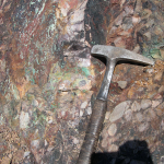
Core/RC geological logging and core structural and geotechnical logging in compliance with international industry standards.
Capturing and analyzing core samples photography.
Storing, managing and validating all drilling data (eg. collars, downhole survey, core orientation, geological, structural and geotechnical logging, photography, assay results and specific gravity measurements).
Generation of drillhole logs.
Interpretation of multiple datasets in an integrated 2-Dimensional environment using Encom Discover MapInfo Software.
Generation of Isopach maps to determine the thickness of the subsurface layers.
Generation of Isopleth (Grade) maps to determine the chemical properties distribution of the subsurface layers.